
Journey the Necklace
Journey the Necklace is a vibrant, self-guided summer adventure that invites you to experience the full Emerald Necklace—one stunning park at a time. Get ready to explore, move, and connect with one of Massachusetts’ most beautiful park systems in a whole new way!
This is not just a walk or a run—it is your chance to turn the entire summer into an outdoor journey. With six unique routes to discover, each highlighting a different section of the Necklace, you can choose your own pace, your own schedule, and your own style of adventure. Whether you are strolling with friends or family, jogging solo, pushing a stroller, or rolling along with a mobility device, there is a place for you here.
Designed for all ages and abilities, Journey the Necklace is flexible, welcoming, and full of opportunities to enjoy nature, stay active, and be part of a shared community experience—all while supporting the Conservancy’s mission to care for these iconic landscapes.
- Walk, roll, run or bike (where permitted)—every route is yours to enjoy your way
- Complete each route on your own time, at your own pace
- Track your progress with a simple honor-system form
- Finish all six routes and earn a special souvenir
Make this your summer “don’t miss” activity—an easy, fun, and meaningful way to get outside, explore, and experience the Emerald Necklace like never before.
How to Participate
- Check out our routes (information on how to access them below) and complete your explorations of all six parks by September 30. You can walk, run, or in some cases, bike, through each of the parks.
- Share your photos on social media and tag the Emerald Necklace Conservancy using #EmeraldJourney.
- When you’ve completed routes through all six parks, fill out our form to receive your special souvenir: a custom Emerald Necklace Conservancy bamboo utensil set! Prizes may be picked up at the Conservancy’s Shattuck Visitor Center.
Utensil sets will be available beginning 7/1. The Shattuck Visitor Center is open 9:30AM and 5PM Monday-Friday. Starting in June, you can also stop by on weekends between 10AM and 4PM.
Route Information
Journey the Necklace participants can explore eight unique routes, each full of curated facts and information about these amazing parks you will discover.
View the collection of routes here or click on the individual route links below.
Journey Details
- When: May 15, 2026 – September 30, 2026
- Where: Throughout the Emerald Necklace parks
Journey Routes
Routes may be completed in any order. Each route will include:
- Information on distance, elevation, and type of path (paved or not)
- Route map and wayfinding guidance with educational content about each park and the Conservancy’s work
- Bathrooms and water fountains where available
Questions about Journey the Necklace?
Call the Shattuck Visitor Center at 617.522.2700 or email our events team.
How to Access
Journeying with Ride with GPS (Recommended)
- Download the Ride with GPS app from the Apple App Store or Google Play store.
- Search Ride with GPS in the app store and download the application. You do NOT need to make an account to use the routes!
- Ensure that your phone settings allow the application to access your location while in use.
- Click this link to access the Journey the Necklace route collection, which will open in the application.
- Choose your route. Click “Go to Route.”
- Next to the name of the route, pull up to expand the route information.
- Select “cuesheet” to follow directions along the route.
- Note: Turn-by-turn voice guidance is only available with a paid account.
- Make your way to the start of the route, marked by a green square with a white arrow inside. Click on the icon to read an introduction to the park!
- Start your journey!
Journeying by Browser on iPhone or Android
- Note: When in the browser, the app does not show your current location on the route. You will need to use the Ride with GPS app for that functionality.
- Click the link to access the Journey the Necklace route collection, which will open in your phone’s default browser.
- Choose your route. Click “Go to Route.”
- Click the map to make it full screen.
- Make your way to the start of the route, marked by a green square with a white arrow inside. Click on the icon to read an introduction to the park!
- Start your journey!
Tips and Tricks:
- Don’t forget to click on the icon for each “waypoint” as you go to read about the different parts of our amazing parks! You may need to click “read more” to see the entire waypoint description.
Connecting with Strava
If you’d like your journeys from Ride with GPS to sync to your Strava account, check out the easy directions to connect with Strava here!
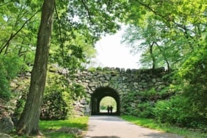
Franklin Park
Click for Trail
- Distance: 3.8 miles
- Elevation: 208 feet
- Surface Description: Mix of paved, grass, and dirt surfaces
- Biking: Permitted
Franklin Park (Shorter Route)
Click for Trail
- Distance: 2.5 miles
- Elevation: 132 feet
- Surface Description: 100% paved. Due to construction, walking on grass is required in one area. One can also continue onto the Franklin Park Service Road from Shattuck Hospital to Scarboro Pond path to stay on paved paths
- Biking: Permitted
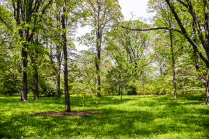
Arnold Arboretum
Click for Trail
- Distance: 3.9 miles
- Elevation: 315 feet
- Surface Description: Some paved and some dirt paths. Portions of the route have rocks and roots on the trail. The route includes a few hills.
- Biking: Not permitted on unpaved paths
Arnold Arboretum (Shorter Route)
Click for Trail
- Distance: 2.3 miles
- Elevation: 126 feet
- Surface Description: 100% paved
- Biking: Permitted re pedestrian only.
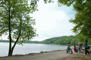
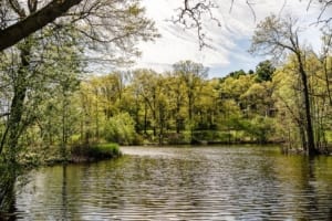
Jamaica Pond
Click for Trail
- Distance: 2 miles
- Elevation: 58 feet
- Surface Description: 100% paved
- Biking: Not permitted

Olmsted Park
Click for Trail
- Distance: 1.7 miles
- Elevation: 76 feet
- Surface Description: 100% paved if staying on the bike path. Participants can choose to take the dirt path more interior to the park on the Boston side of the route rather than the paved multi-use path closer to Arborway.
- Biking: Permitted on the designated bike path. Bikes are not permitted on the dirt pedestrian paths.
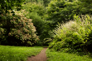
Riverway
Click for Trail
-
- Elevation: 7 feet
- Surface Description: 100% paved on the Brookline side, mostly dirt on the Boston side.
- Biking: Permitted
Back Bay Fens
Click for Trail
- Distance: 1.7 miles
- Elevation: 13 feet
- Surface Description: 100% paved if staying on the exterior multi-use paths. Please note that bikers may be present. Participants can also utilize pedestrian-only dirt paths more interior to the park.
- Biking: Permitted on paths on the edge of the park. More interior paths are pedestrian only.
